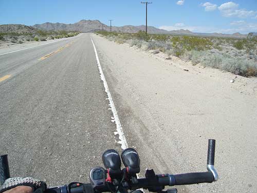
 Kelbaker Road rises out of Kelso Valley toward the power lines with Marl Mountains as a backdrop
OK, off I go, riding away from Kelso Depot, into the heat of the day on the 10-ton bike. Destination still not chosen yet.
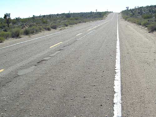 Rough pavement on Kelbaker Road, and one final short, steep hill before reaching the summit
at the power line
Rough pavement on Kelbaker Road, and one final short, steep hill before reaching the summit
at the power lineI'm heading back toward Baker. Tomorrow night I want to sleep in a motel there and be ready for my Amtrak bus the following morning. There are plenty of places that would make interesting campsites tonight along the way.
The hill out of the valley from Kelso, starting at 2123 feet elevation, is a bit steeper going toward Baker than it is in when arriving from there. It might be slower, but it's actually easier because it's visually more interesting and it doesn't last for as many miles.
I seem to have the wind behind me, and this is always a plus.
The heat makes me stop regularly for water breaks. I only have two Clif bars left, so I save them until later. I chew on dried apricots instead. As I get closer to the top of the hill, it hits me that it's time to decide where I'm going to spend the night!
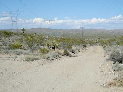 Leaving Kelbaker Road on the powerline road, heading northeast toward the Marl Mountains
Time evaporates in the heat, and I've just reached the summit of Kelbaker Road at 3800 feet. The powerline road that crosses there begs for my attention, as it often does when I pass here. Though rough, it looks like it's probably ridable in both directions.
I could take the powerline road southwest a few miles and camp out somewhere just before it descends into Jackass Canyon, an area that I keep saying I want to visit.
Or I could head northeast on the powerline road toward Marl Springs, another area that I'd like to explore.
Or I could just keep heading westward on Kelbaker Road like I'm doing and camp out somewhere near the lava flows—perhaps off Rainy Day Mine Road or Aiken Mine Road. Nawww, I camped by lava flows a couple of nights ago—I should try something different
Randomly, I choose to head toward Marl Springs on the powerline road, perhaps just because I know that people do camp in that area along the old Mojave Road.